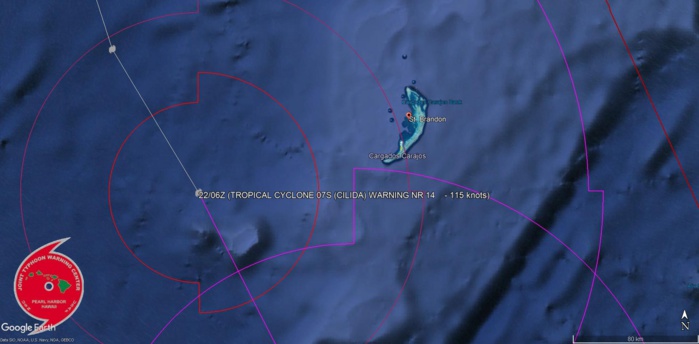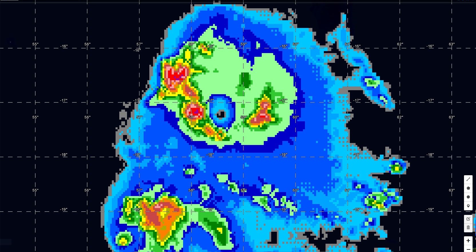
Cliquez sur l'image.Le cyclone intense passe à un peu plus de 110km des îles de Saint Brandon ou les conditions sont cycloniques.
2018 DEC 22 12h55 Mascareignes.
Le cyclone tropical intense CILIDA est centré à quelques 110km des îles sud de Saint Brandon en ce moment.
Dans son communiqué en anglais(voir ci dessous) MMS/Vacoas fait mention de rafales à 160km/h avec des pointes possibles à 200km/h alors que le cyclone passe en ce moment à son point le plus rapproché des îles qui sont peuplées par des pêcheurs et des officiels(Coast Guard et météo).
La mer est "démontée". A ce propos il faut savoir que les îles à peine plus élevées que le niveau de la mer sont souvent partiellement recouvertes(quelques fois entièrement) lors des grands épisodes cycloniques.
COURAGE à eux. On pense à vous...
"Bulletin prévision - St Brandon MMS/VACOAS
Special communique for St Brandon issued at 12 00 hr this Saturday 22 December 2018.
Intense tropical cyclone CILIDA is influencing weather over the island.
At 1000 hrs this morning, Intense Tropical Cyclone 'CILIDA' was centred around the point 16.9 degrees South in latitude and 58.4 degrees East in longitude that is at about 110 km to the West-South-West of St Brandon.
During the past 12 hours, Cilida has been moving in a South-South-Easterly direction at an accelerated speed of about 15km/h.
On this trajectory, Cilida is passing at its closest distance from the island and cyclonic conditions are prevailing. The intense tropical cyclone will start to move away from St-Brandon region as from tonight.
Weather forecast for next 24 hours.
Clouds in the circulation of Cilida are influencing the local weather with heavy showers and wind gusts of the order of 160 km/h, together with very high to phenomenal seas.
The showers are likely to be violent with thunderstorms as from now, with gusts reaching 200 km/h.
Outlook for 23 December 2018:
The Intense Tropical Cyclone Cilida will start to move away from the region and winds will decrease gradually as from tomorrow. However, the sea will remain very rough with swells. The weather will remain cloudy to overcast in the outer cloud bands of Cilida with rain showers moderate to heavy at times with thunderstorms.
This communique will be updated tomorrow, Sunday 22 December 2018 at around 11.30 hours local time."
Cheers,
Patrick Hoareau.


